Pharmacy nearby Apotheek Mathet
Belgium
Pharmacy nearby Apotheek Mathet
Apotheek Mathet
Brussel België
contacts phone
:
+32
Latitude:
50.8932842
, Longitude:
4.3709493
read more
nearest Pharmacy
Pharmacie Mathet-Desmet
Brussels
Pharmacy
read more
691 m
Bauduin Pharmacie Apotheek
Rue de Beyseghem 82, Bruxelles
Pharmacy
read more
879 m
Pharmacie Taous
Brussels
Pharmacy
read more
883 m
Apotheek Pharmacie Matton bvba
Frans Vekemansstraat 209, Brussel
Pharmacy
read more
956 m
Pharmacie Gemine
Rue de Wand 27, Bruxelles
Pharmacy
read more
962 m
Pharmacie Dahmen-Sadones
Brussels
Pharmacy
read more
1.071 km
Pharmacie Mutsaerd
Brussels
Pharmacy
read more
1.122 km
Apotheek LloydsPharma Bruxelles de Neder
Frans Vekemansstraat 127, Brussel
Pharmacy
read more
1.263 km
Apotheek Sint Anna
Sint Anna Laan 16
Pharmacy
read more
1.29 km
Apotheek Ten Voorde
Steenstraat 96, Vilvoorde
Pharmacy
read more
1.46 km
Apotheek Jaspers
Sint-Amandsstraat 159, Grimbergen
Pharmacy
read more
2.039 km
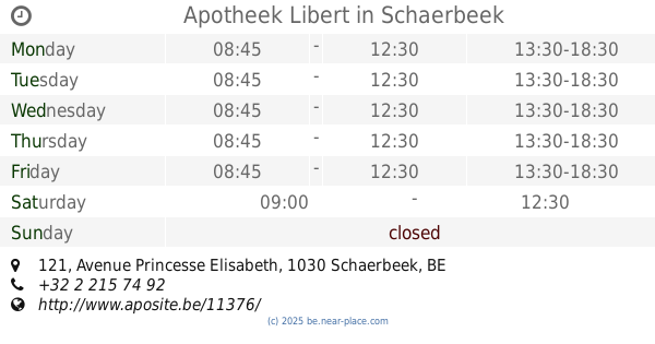
Apotheek Libert
Avenue Princesse Elisabeth 121, Schaerbeek
Pharmacy
read more
2.061 km
Apotheek De Backer
Gemeenteplein 4, Grimbergen
Pharmacy
read more
2.079 km
Pharmacie Dejong
Schaerbeek
Pharmacy
read more
2.17 km
Pharmacie du Stuyvenbergh
Brussels
Pharmacy
read more
2.172 km
Apotheek Segers
Rue Bruyn 227, Bruxelles
Pharmacy
read more
2.32 km
Pharmacie Marie-Christine
Rue Marie-Christine 157/A, Bruxelles
Pharmacy
read more
2.356 km
fermacell kenzai
fermacell kenzai
Pharmacy
read more
2.359 km
Pharmacie Engels sprl
Brussels
Pharmacy
read more
2.421 km
Apotheek Finne
Helmetsesteenweg 373, Schaarbeek
Pharmacy
read more
2.421 km
Finné S.
Chaussée de Helmet 373, Schaerbeek
Pharmacy
read more
2.466 km
Multipharma
Emile Bockstaelplein 1, Brussel
Pharmacy
read more
2.466 km
Multipharma
Place Emile Bockstael 1, Bruxelles
Pharmacy
read more
2.467 km
Nestour / Guy
Leopold I-straat 147, Brussel
Pharmacy
read more
2.555 km
Laboratoires Forte Pharma Benelux SA
Font Saint Landry 6, Bruxelles
Pharmacy
read more
📑
all categories
Accounting
Administrative area level 1
Administrative area level 2
Airport
Amusement park
Aquarium
Art gallery
Atm
Bakery
Bank
Bar
Beauty salon
Bicycle store
Book store
Bowling alley
Bus station
Cafe
Campground
Car dealer
Car rental
Car repair
Car wash
Casino
Cemetery
Church
City hall
Clothing store
Colloquial area
Convenience store
Country
Courthouse
Dentist
Department store
Doctor
Electrician
Electronics store
Embassy
Finance
Fire station
Florist
Food
Funeral home
Furniture store
Gas station
General contractor
Grocery or supermarket
Gym
Hair care
Hardware store
Health
Hindu Temple
Home goods store
Hospital
Insurance agency
Jewelry store
Laundry
Lawyer
Library
Light rail station
Liquor store
Local government office
Locality
Locksmith
Lodging
Meal delivery
Meal takeaway
Mosque
Movie rental
Movie theater
Moving company
Museum
Natural feature
Neighborhood
Night club
Painter
Park
Parking
Pet store
Pharmacy
Physiotherapist
Place of worship
Plumber
Point of interest
Police
Political
Post office
Premise
Real estate agency
Restaurant
Roofing contractor
Route
Rv park, camping
School
Shoe store
Shopping mall
Spa
Stadium
Storage
Store
Subpremise
Subway station
Supermarket
Synagogue
Taxi stand
Train station
Transit station
Travel agency
University
Veterinary care
Zoo
sublocality level 1
sublocality level 2
sublocality level 3
↑