Gas station nearby Total
Belgium
Gas station nearby Total
Total
E40 Bruxelles--Liege, Hoegaarden Belgium
contacts phone
:
+32
Latitude:
50.7533308
, Longitude:
4.9513108
read more
nearest Gas station
1 m
Total
E40, Hoegaarden-Liege, Hoegaarden
Gas station
read more
106 m
Total
Hoegaarden
Gas station
read more
2.498 km
Octa+
Rue du Moulin 14, Hélécine
Gas station
read more
3.609 km
Total
Rue Ferdinand Smeers 4, Noduwez
Gas station
read more
3.618 km
Dethiege Et Cie
Rue Ferdinand Smeers 4, Noduwez
Gas station
read more
4.574 km
Shell
Chaussée de Tirlemont 721, Jodoigne
Gas station
read more
5.293 km
octaplus
Chaussée de Tirlemont 222, Jodoigne
Gas station
read more
5.298 km
Octa+
Chaussée de Tirlemont 223, Jodoigne
Gas station
read more
5.351 km
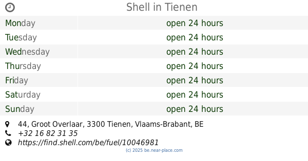
Shell
Groot Overlaar 44, Tienen
Gas station
read more
5.569 km
Total
Sint-Truidensesteenweg 573, Tienen
Gas station
read more
6.101 km
Tienen Hakendover Maes
Sint-Truidensesteenweg 602, Tienen
Gas station
read more
6.158 km
Renier - Lecocq et Fils
Rue de Septembre 22, Jodoigne
Gas station
read more
6.318 km
Shell
Chaussée de Hannut 10, Jodoigne
Gas station
read more
6.449 km
Total
Rue du Bosquet 1, Jodoigne
Gas station
read more
6.756 km
Shell
Albertvest 15, Tienen
Gas station
read more
6.776 km
Shell Express
Albertvest 15, Tienen
Gas station
read more
6.809 km
Tankstation Delvaux Europalace
Linter,3350, Linter
Gas station
read more
9.207 km
Total
Postlaan 4, Landen
Gas station
read more
9.41 km
TOTAL VBS ORSMAAL NV
ST Truidenstwg
Gas station
read more
11.467 km
Gulf - Linter
Grote Steenweg 176, Linter
Gas station
read more
12.738 km
Total
Steenweg 158, Gingelom
Gas station
read more
13.084 km
Total
Tiensesteenweg 116, Binkom
Gas station
read more
14.14 km
Texaco
Sint-Truidensesteenweg 43, Zoutleeuw
Gas station
read more
14.158 km
Esso
Bogaerdenstraat 37, Zoutleeuw
Gas station
read more
14.159 km
Desard / Willy
Sint-Truidensesteenweg 43, Zoutleeuw
Gas station
read more
📑
all categories
Accounting
Administrative area level 1
Administrative area level 2
Airport
Amusement park
Aquarium
Art gallery
Atm
Bakery
Bank
Bar
Beauty salon
Bicycle store
Book store
Bowling alley
Bus station
Cafe
Campground
Car dealer
Car rental
Car repair
Car wash
Casino
Cemetery
Church
City hall
Clothing store
Colloquial area
Convenience store
Country
Courthouse
Dentist
Department store
Doctor
Electrician
Electronics store
Embassy
Finance
Fire station
Florist
Food
Funeral home
Furniture store
Gas station
General contractor
Grocery or supermarket
Gym
Hair care
Hardware store
Health
Hindu Temple
Home goods store
Hospital
Insurance agency
Jewelry store
Laundry
Lawyer
Library
Light rail station
Liquor store
Local government office
Locality
Locksmith
Lodging
Meal delivery
Meal takeaway
Mosque
Movie rental
Movie theater
Moving company
Museum
Natural feature
Neighborhood
Night club
Painter
Park
Parking
Pet store
Pharmacy
Physiotherapist
Place of worship
Plumber
Point of interest
Police
Political
Post office
Premise
Real estate agency
Restaurant
Roofing contractor
Route
Rv park, camping
School
Shoe store
Shopping mall
Spa
Stadium
Storage
Store
Subpremise
Subway station
Supermarket
Synagogue
Taxi stand
Train station
Transit station
Travel agency
University
Veterinary care
Zoo
sublocality level 1
sublocality level 2
sublocality level 3
↑