Cemetery nearby Friedhof Meyerode
Belgium
Cemetery nearby Friedhof Meyerode
Friedhof Meyerode
Martinusstraße, Amel Belgium
contacts phone
:
+32
Latitude:
50.3307545
, Longitude:
6.1870012
read more
nearest Cemetery
3.162 km
Friedhof Amel
Zum Knopp 70, Amel
Cemetery
read more
4.003 km
Friedhof Heppenbach
Amel
Cemetery
read more
4.415 km
Friedhof Deidenberg
Lindenallee 23, Amel
Cemetery
read more
5.271 km
Friedhof Born
Montenauer Straße 25, Amel
Cemetery
read more
6.212 km
Friedhof Schoppen
Jonzeburen, Amel
Cemetery
read more
6.987 km
Cimetière de Stephanshof
Stefanshof 4770, Amel
Cemetery
read more
9.289 km
Friedhof Büllingen
Morsheck 10, Büllingen
Cemetery
read more
10.824 km
MARCHIN
4570,, Belair, Waimes
Cemetery
read more
10.989 km
Friedhof Bütgenbach
Klosterstraße 16, Bütgenbach
Cemetery
read more
11.022 km
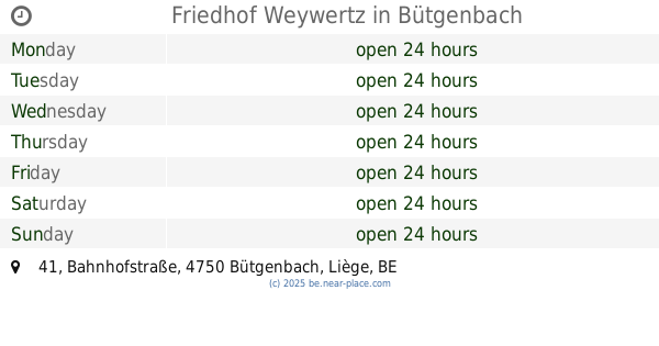
Friedhof Weywertz
Bahnhofstraße 41, Bütgenbach
Cemetery
read more
11.036 km
Cimetière de Waimes
Waimes
Cemetery
read more
12.974 km
Friedhof Nidrum
Kirchstraße 28, Bütgenbach
Cemetery
read more
13.676 km
Friedhof Rocherath
Büllingen
Cemetery
read more
14.166 km
Friedhof Elsenborn
Desherenborn 34, Bütgenbach
Cemetery
read more
15.74 km
Friedhof Malmedy
Rue du Rond-Thier 12C, Malmedy
Cemetery
read more
17.515 km
Dimitri Blaise Pierres Naturelles SA
Au-dessus des Trous 4, Malmedy
Cemetery
read more
24.766 km
Monument à la mémoire de l'équipage du Lancaster
Unnamed Road, 4900, Spa
Cemetery
read more
29.465 km
Cimetière de Spa
5 6, Overpelt
Cemetery
read more
31.792 km
Begraafplaats
4910, Theux
Cemetery
read more
36.566 km
Cimetière - Boeur
Boeur 17, Houffalize
Cemetery
read more
36.9 km
Cimetiere Hauts Sarts
Pepinster
Cemetery
read more
42.586 km
Maison Bernard-Defèche
Noville 11, Bastogne
Cemetery
read more
49.485 km
Begraafplaats Remersdaal
Born 83-79, Voeren
Cemetery
read more
57.298 km
Cimetière de Vottem
Chaussée Brunehault 491, Herstal
Cemetery
read more
58.988 km
Cimetière
Tillet 82, Sainte-Ode
Cemetery
read more
📑
all categories
Accounting
Administrative area level 1
Administrative area level 2
Airport
Amusement park
Aquarium
Art gallery
Atm
Bakery
Bank
Bar
Beauty salon
Bicycle store
Book store
Bowling alley
Bus station
Cafe
Campground
Car dealer
Car rental
Car repair
Car wash
Casino
Cemetery
Church
City hall
Clothing store
Colloquial area
Convenience store
Country
Courthouse
Dentist
Department store
Doctor
Electrician
Electronics store
Embassy
Finance
Fire station
Florist
Food
Funeral home
Furniture store
Gas station
General contractor
Grocery or supermarket
Gym
Hair care
Hardware store
Health
Hindu Temple
Home goods store
Hospital
Insurance agency
Jewelry store
Laundry
Lawyer
Library
Light rail station
Liquor store
Local government office
Locality
Locksmith
Lodging
Meal delivery
Meal takeaway
Mosque
Movie rental
Movie theater
Moving company
Museum
Natural feature
Neighborhood
Night club
Painter
Park
Parking
Pet store
Pharmacy
Physiotherapist
Place of worship
Plumber
Point of interest
Police
Political
Post office
Premise
Real estate agency
Restaurant
Roofing contractor
Route
Rv park, camping
School
Shoe store
Shopping mall
Spa
Stadium
Storage
Store
Subpremise
Subway station
Supermarket
Synagogue
Taxi stand
Train station
Transit station
Travel agency
University
Veterinary care
Zoo
sublocality level 1
sublocality level 2
sublocality level 3
↑