Taxi stand nearby taxi vervoer luchthavenvervoer
Coronavirus disease (COVID-19) Situation
confirmed cases
4861695
deaths
34376
Belgium
Taxi stand nearby taxi vervoer luchthavenvervoer
taxi vervoer luchthavenvervoer
5, Fabriekstraat, 9300, Aalst, Oost-Vlaanderen, BE België
contacts phone
:
+32 479 44 66 69
website:
www.decotaxi.be
Latitude:
50.9419789
, Longitude:
4.0364603
larger map & directions
read more
nearest Taxi stand
17.599 km
Taxis Vlaams Brabant
Ninoofsesteenweg 608 B, Dilbeek
Taxi stand
read more
21.189 km
Pantheon
Ganshoren
Taxi stand
read more
21.859 km
Heyzel - Miramar
Brussel
Taxi stand
read more
22.35 km
Beekkant
St-Jan-Molenbeek
Taxi stand
read more
23.868 km
タクシー乗り場
Unnamed Road、1070, Anderlecht
Taxi stand
read more
24.73 km
Rochefort (Place)
Forest
Taxi stand
read more
25.039 km
Poelaert
Brussels
Taxi stand
read more
25.118 km
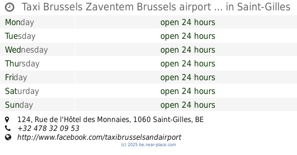
Taxi Brussels Zaventem Brussels airport ...
Rue de l'Hôtel des Monnaies 124, Saint-Gilles
Taxi stand
read more
25.209 km
Enseignement
Brussels
Taxi stand
read more
25.209 km
Enseignement
Bruxelles
Taxi stand
read more
25.362 km
Sofitel
Brussels
Taxi stand
read more
25.574 km
De Stefania-Waterbekken
Elsene
Taxi stand
read more
25.611 km
Coghen
Uccle
Taxi stand
read more
25.624 km
Bastion
Ixelles
Taxi stand
read more
26.305 km
Spaak
Elsene
Taxi stand
read more
26.305 km
Spaak
Ixelles
Taxi stand
read more
27.314 km
Louiza Claus
Brussel
Taxi stand
read more
27.314 km
Louise Claus
Brussels
Taxi stand
read more
27.314 km
Louise Claus
Bruxelles
Taxi stand
read more
27.432 km
Louise - Legrand
Bruxelles
Taxi stand
read more
27.432 km
Louise - Legrand
Brussels
Taxi stand
read more
28.557 km
Solbosch
Elsene
Taxi stand
read more
28.668 km
Vivier d'Oie
Brussels
Taxi stand
read more
28.668 km
Diesdelle
Brussel
Taxi stand
read more
30.889 km
Rode Taxi Rhode saint Genèse
Chemin du Champ de l'Eglise 35, Rhode-Saint-Genèse
Taxi stand
read more
📑
all categories
Accounting
Administrative area level 1
Administrative area level 2
Airport
Amusement park
Aquarium
Art gallery
Atm
Bakery
Bank
Bar
Beauty salon
Bicycle store
Book store
Bowling alley
Bus station
Cafe
Campground
Car dealer
Car rental
Car repair
Car wash
Casino
Cemetery
Church
City hall
Clothing store
Colloquial area
Convenience store
Country
Courthouse
Dentist
Department store
Doctor
Electrician
Electronics store
Embassy
Finance
Fire station
Florist
Food
Funeral home
Furniture store
Gas station
General contractor
Grocery or supermarket
Gym
Hair care
Hardware store
Health
Hindu Temple
Home goods store
Hospital
Insurance agency
Jewelry store
Laundry
Lawyer
Library
Light rail station
Liquor store
Local government office
Locality
Locksmith
Lodging
Meal delivery
Meal takeaway
Mosque
Movie rental
Movie theater
Moving company
Museum
Natural feature
Neighborhood
Night club
Painter
Park
Parking
Pet store
Pharmacy
Physiotherapist
Place of worship
Plumber
Point of interest
Police
Political
Post office
Premise
Real estate agency
Restaurant
Roofing contractor
Route
Rv park, camping
School
Shoe store
Shopping mall
Spa
Stadium
Storage
Store
Subpremise
Subway station
Supermarket
Synagogue
Taxi stand
Train station
Transit station
Travel agency
University
Veterinary care
Zoo
sublocality level 1
sublocality level 2
sublocality level 3
↑