School nearby Impact Centre Chrétien Be
Belgium
School nearby Impact Centre Chrétien Be
Impact Centre Chrétien Be
Rue des Lutins 8, Forest Belgium
contacts phone
:
+32
Latitude:
50.7999346
, Longitude:
4.3149092
read more
nearest School
479 m
Ukkel
Poldersstraat 53, Ukkel
School
read more
479 m
Ukkel
Rue des Polders 53, Uccle
School
read more
484 m
Icpp
Rue des Polders 53, Uccle
School
read more
521 m
Ecole du Merlo
Merlostraat 16, Ukkel
School
read more
553 m
Pavillon des Tilleuls
Avenue des Familles 25, Forest
School
read more
583 m
Kinder-En Jeugdzorg Ukkel-Stalle
Baron Guillaume Van Hammestraat 33, Ukkel
School
read more
727 m
La Maison Des Mille Couleurs
Generaal Dumonceaulaan 60, Brussel
School
read more
727 m
New Era
Generaal Dumonceaulaan 60, Vorst
School
read more
728 m
Ecole Saint-Curé D'ars
Avenue Stuart Merrill 20, Forest
School
read more
738 m
Sfpme
b, Rue de Stalle 292, Uccle
School
read more
833 m
Institut Decroly A.s.b.l.
Bamboestraat 9, Ukkel
School
read more
842 m
Institute Secondary Education Specialise - Decroly
Uccle
School
read more
842 m
Institut D'enseignement Secondaire Specialise - Decroly
Ukkel
School
read more
883 m
Rods
Fleurbeekstraat 9, Drogenbos
School
read more
894 m
Aux Chérubins
Gatti de Gamondstraat 196, Ukkel
School
read more
894 m
Aux Chérubins
Rue Gatti de Gamond 196, Uccle
School
read more
936 m
Le Val Fleuri
Gatti de Gamondstraat 140, Ukkel
School
read more
936 m
Le Val Fleuri
Rue Gatti de Gamond 140, Uccle
School
read more
975 m
Gemeentelijke basisschool “De Wereldbrug”
Rue de Hal 34, Forest
School
read more
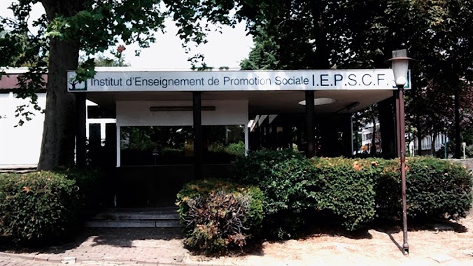
977 m
Iepscf-Uccle
Rue Gatti de Gamond 95, Uccle
School
read more
1.052 km
Manger Les Papillons
Achille Reisdorfflaan 8, Ukkel
School
read more
1.237 km
Middenschool Van Het Gemeenschapsonderwijs Ukkel - Beersel
Ukkel
School
read more
1.247 km
Middenschool Van Het Gemeenschapsonderwijs Ukkel Beersel
Uccle
School
read more
1.267 km
Fieuw - Geyssels / M.
Avenue du Domaine 17, Forest
School
read more
1.267 km
Fieuw - Geyssels / M.
Domeinlaan 17, Vorst
School
read more
📑
all categories
Accounting
Administrative area level 1
Administrative area level 2
Airport
Amusement park
Aquarium
Art gallery
Atm
Bakery
Bank
Bar
Beauty salon
Bicycle store
Book store
Bowling alley
Bus station
Cafe
Campground
Car dealer
Car rental
Car repair
Car wash
Casino
Cemetery
Church
City hall
Clothing store
Colloquial area
Convenience store
Country
Courthouse
Dentist
Department store
Doctor
Electrician
Electronics store
Embassy
Finance
Fire station
Florist
Food
Funeral home
Furniture store
Gas station
General contractor
Grocery or supermarket
Gym
Hair care
Hardware store
Health
Hindu Temple
Home goods store
Hospital
Insurance agency
Jewelry store
Laundry
Lawyer
Library
Light rail station
Liquor store
Local government office
Locality
Locksmith
Lodging
Meal delivery
Meal takeaway
Mosque
Movie rental
Movie theater
Moving company
Museum
Natural feature
Neighborhood
Night club
Painter
Park
Parking
Pet store
Pharmacy
Physiotherapist
Place of worship
Plumber
Point of interest
Police
Political
Post office
Premise
Real estate agency
Restaurant
Roofing contractor
Route
Rv park, camping
School
Shoe store
Shopping mall
Spa
Stadium
Storage
Store
Subpremise
Subway station
Supermarket
Synagogue
Taxi stand
Train station
Transit station
Travel agency
University
Veterinary care
Zoo
sublocality level 1
sublocality level 2
sublocality level 3
↑