Restaurant nearby `t Pleintje
Belgium
Restaurant nearby `t Pleintje
`t Pleintje
Stationsplein 3, Brakel Belgium
contacts phone
:
+32
Latitude:
50.8003577
, Longitude:
3.7665068
read more
nearest Restaurant
307 m
die bronne
Kasteelstraat 11, Brakel
Restaurant
read more
313 m
De Vijf Seizoenen
Kasteelstraat 5, Brakel
Restaurant
read more
320 m
Broodjeszaak Dekarroo
Kasteelstraat 14, Brakel
Restaurant
read more
327 m
Restaurant Carvin Olifantstraat
Stationsstraat 12-14, Brakel
Restaurant
read more
351 m
Snack Antalya
Hoogstraat 18, Brakel
Restaurant
read more
353 m
Fu Hao Garden
Wielendaalstraat 5
Restaurant
read more
433 m
The Shake
Marktplein 3, Brakel
Restaurant
read more
433 m
Lemeire / Francis
Marktplein 3, Brakel
Restaurant
read more
438 m
't Zwart Licht
Marktplein 6, Brakel
Restaurant
read more
442 m
Brachelius
Marktplein 5, Brakel
Restaurant
read more
451 m
Rofarm bvba
Marktplein 4, Brakel
Restaurant
read more
507 m
Moeder Agnes
Olifantstraat 6, Brakel
Restaurant
read more
536 m
Pizza Luna
Rondplein 2, Brakel
Restaurant
read more
702 m
Eekeveld
Ronsesestraat 18, Brakel
Restaurant
read more
890 m
La Villa
Brusselsestraat 63, Brakel
Restaurant
read more
890 m
Donin Lucio
Brusselsestraat 63, Brakel
Restaurant
read more
1.161 km
De Vos / Mireille
Sint-Ursmarsstraat 33, Brakel
Restaurant
read more
1.187 km
Frituur Den Uil
Brusselsestraat 130, Nederbrakel
Restaurant
read more
2.107 km
Van Nieuwenhove / Elke
Twaalfbunderstraat 69, Brakel
Restaurant
read more
2.798 km
DICTADO WINKEL - FRITUUR
Oudenaardsestraat 39, Brakel
Restaurant
read more
3.61 km
Café Manger
Sint-Sebastiaansplein 1, Brakel
Restaurant
read more
4.912 km
The Phlox
Reepstraat 42, Brakel
Restaurant
read more
5.413 km
'T Barakske
D'Hoppe 7, Vloesberg
Restaurant
read more
5.512 km
Brasserie D'Hoppe
D'Hoppe, Vloesberg
Restaurant
read more
6.1 km
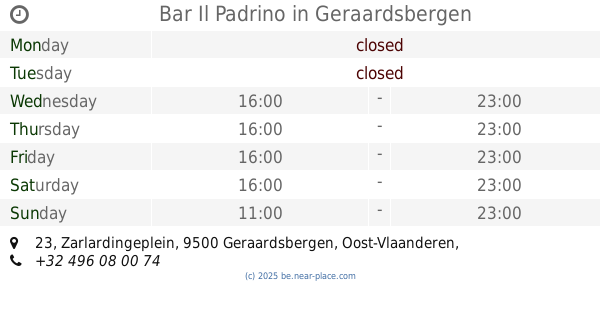
Bar Il Padrino
Zarlardingeplein 23, Geraardsbergen
Restaurant
read more
📑
all categories
Accounting
Administrative area level 1
Administrative area level 2
Airport
Amusement park
Aquarium
Art gallery
Atm
Bakery
Bank
Bar
Beauty salon
Bicycle store
Book store
Bowling alley
Bus station
Cafe
Campground
Car dealer
Car rental
Car repair
Car wash
Casino
Cemetery
Church
City hall
Clothing store
Colloquial area
Convenience store
Country
Courthouse
Dentist
Department store
Doctor
Electrician
Electronics store
Embassy
Finance
Fire station
Florist
Food
Funeral home
Furniture store
Gas station
General contractor
Grocery or supermarket
Gym
Hair care
Hardware store
Health
Hindu Temple
Home goods store
Hospital
Insurance agency
Jewelry store
Laundry
Lawyer
Library
Light rail station
Liquor store
Local government office
Locality
Locksmith
Lodging
Meal delivery
Meal takeaway
Mosque
Movie rental
Movie theater
Moving company
Museum
Natural feature
Neighborhood
Night club
Painter
Park
Parking
Pet store
Pharmacy
Physiotherapist
Place of worship
Plumber
Point of interest
Police
Political
Post office
Premise
Real estate agency
Restaurant
Roofing contractor
Route
Rv park, camping
School
Shoe store
Shopping mall
Spa
Stadium
Storage
Store
Subpremise
Subway station
Supermarket
Synagogue
Taxi stand
Train station
Transit station
Travel agency
University
Veterinary care
Zoo
sublocality level 1
sublocality level 2
sublocality level 3
↑